Geo-Informatics Engineer
a guide to: Career
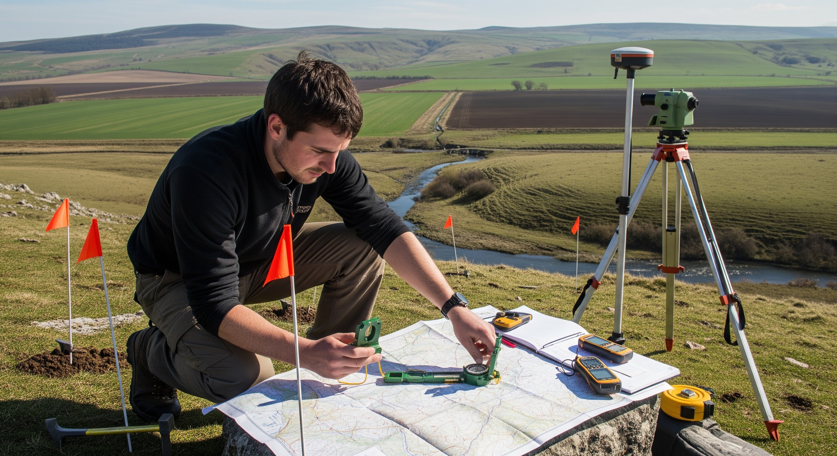
What is a Geo-Informatics Engineer?
A Geo-Informatics Engineer is a specialized professional who integrates information technology with geosciences. They develop systems to capture, analyze, and visualize spatial data using technologies like GIS (Geographic Information Systems), Remote Sensing, and GPS to solve complex geographical and environmental problems efficiently.
Why is a Geo-Informatics Engineer important?
Geo-Informatics Engineers are vital for modern infrastructure and environmental protection. They provide the spatial intelligence required for precision agriculture, disaster management, and urban planning, ensuring resources are used sustainably and safely in a data-driven world.
- Precision Planning:
- Enables accurate site selection and efficient resource allocation for large-scale construction and infrastructure projects.
- Disaster Resilience:
- Predicts and models floods, earthquakes, and landslides to reduce risks and minimize loss of life and property.
- Environmental Monitoring:
- Tracks deforestation, air quality, land use, and climate change patterns using real-time geospatial data.
- Smart Mobility:
- Powers navigation systems, route optimization, and intelligent traffic management in modern smart cities.
As global challenges like climate change and rapid urbanization grow, Geo-Informatics Engineers are essential for transforming raw geospatial data into actionable insights for a more resilient and sustainable future.

Education Pathways
Option 01
Stream

Important Subjects
| # | Subject |
|---|---|
| 1 | Failure Analysis – Systematic investigation of how and why a component, system, or structure failed. |
| 2 | Materials Science – Studying the properties of metals, polymers, composites, and concrete under mechanical and thermal stress. |
| 3 | Structural Integrity – Assessing load-bearing capacity, fatigue, and long-term stability of structures. |
| 4 | Accident Reconstruction – Applying physics and engineering principles to recreate vehicle collisions and industrial accidents. |
| 5 | Fire Dynamics – Analyzing the origin, spread, heat transfer, and behavior of fire incidents. |
| 6 | Digital Forensics – Recovering and analyzing data from damaged electronic systems, controllers, and embedded devices. |
| 7 | Ethics & Expert Testimony – Legal and ethical standards for providing unbiased scientific evidence in courts. |
| 8 | Fluid Mechanics – Investigating failures in pipelines, pumps, valves, and hydraulic systems. |
| 9 | Geotechnical Engineering – Analyzing soil and foundation failures, landslides, and earth-retaining structures. |
| 10 | Thermodynamics – Studying heat-related energy changes involved in explosions, fires, and engine failures. |
| 11 | Instrumentation – Using sensors, NDT tools, and microscopes to detect cracks, corrosion, and microscopic defects. |
| 12 | Legal Aspects – Understanding the Indian Evidence Act, criminal procedures, and liability laws relevant to forensic investigations. |
Career Progression for a Geo-Informatics Engineer
Qualification Levels:
- B.Tech/B.sc. for entry roles;
- M.Tech/M.sc. or certifications add advantage.
Role Levels & Growth:
- Entry - GIS Analyst / Junior Geo-Informatics Engineer - Data processing
- Mid-Level - Geo-Informatics Engineer - Project execution
- Senior - Senior GIS / Remote Sensing Engineer - System design
- Lead - Geospatial Lead / GIS Manager - Team leadership
- Expert - Geospatial Consultant / Scientist - Strategic roles
Further Opportunities:
- GIS Specialist
- Senior Engineer
- Project Manager
- Program Manager
- Research, Academia
Sectors Offering
- Urban Planning & Smart Cities: Using GIS and spatial data to design sustainable urban infrastructure, optimize land use, and improve public services.
- Remote Sensing & Satellite Services: Providing satellite imagery acquisition, analysis, and mapping solutions for governments, research, and private clients.
- Disaster Management & Risk Assessment: Mapping flood zones, earthquake-prone areas, and other hazards to develop mitigation strategies and emergency planning.
- Environmental Monitoring & Climate Studies: Tracking deforestation, air and water quality, climate change trends, and ecosystem health using GIS and remote sensing data.
- Transportation & Infrastructure Planning: Designing traffic networks, optimizing routes, and supporting smart mobility projects with geospatial analytics.
- Agriculture & Precision Farming: Applying satellite data and GIS to monitor crop health, optimize irrigation, and improve yield efficiency.
- Defense & Security Mapping: Creating topographic maps, surveillance mapping, and geospatial intelligence for national security and strategic planning.
- Mining & Natural Resource Management: Locating mineral deposits, monitoring extraction impact, and managing forests, water, and land resources.
- Utilities & Energy Sector: Planning and monitoring pipelines, electrical grids, renewable energy sites, and resource distribution networks using spatial analysis.
Expected Salary
Entry Level
- ₹4 - ₹6 LPA
Mid-Level
- ₹7.0 - ₹14.0 LPA
Senior Level
- ₹18.0 - ₹30.0 LPA
International
Entry Level
- $65,000 - $85,000 per annum
Mid/Senior Level
- $95,000 - $190,000 per annum
Design by Find Right Path